|
|
|
|
|
|
|
|
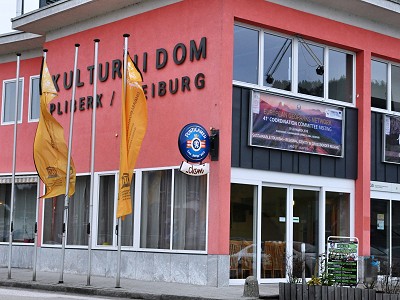
41st EGN Coordination
Committee Meeting
Bleiburg/Pliberk,
Karawanken (Austria-Slovenia), 19th - 23rd March 2018 |
|
|
|
|
|
|
|
PHOTO
CHRONICLE |
|
|
|
|
|
|
|
Monday
19.03.2018
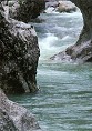
Transfer day from the Apuan Alps to the Karavanke/Karawanken
Austrian/Slovenian cross-border UNESCO Global Geopark. The meeting will
take place in the city of Bleuiburg/Pliberk in Carinthia (Austria). The
historical Austrian/Slovenian name was strongly contested by the
German-speaking Austrian nationalists in the years 2005-2007. The
controversy ended after the statement of the Austrian High Court which
established for this city the bilingual name Bleuiburg/Pliberk.
Currently around 30% of the 4000 inhabitants of the municipality are of
Slovenian origin. |
|
|
|
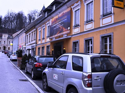
Monday
19.03.2018
Upon arrival, a quick visit to the small city center. The first stop is
at the Kulturni Dom where the 41st Coordination Committee Meeting of the
European Geoparks Network will take place. |
|
|
|
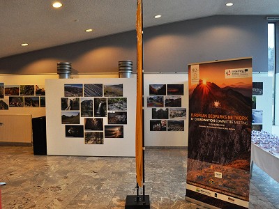
Monday
19.03.2018
An exhibition with photos from all the European geoparks has been set up
in the hall of the Kulturni Dom. The room is empty ... the work will
start tomorrow with the Advisory Committee meeting. |
|
|
|
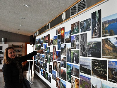
Monday
19.03.2018
After a short search, our Alessia Amorfini identifies one of the images
representing the Apuan Alps Geopark… she does not hold back a smile of
satisfaction. |
|
|
|
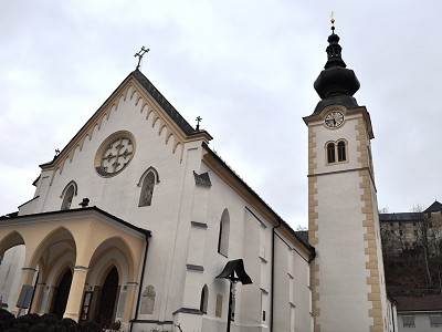
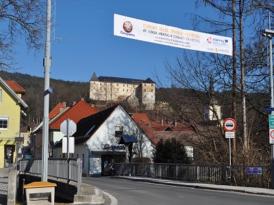
Monday
19.03.2018
Cold temperatures (around -2° C) allow only a short walk for an outdoor
visit. View of the façade of the main church with the castle of Bleiburg/Pliberk
in the background. Bleuiburg means "castle of lead" testifying the link
of this city with the mining activities related to the extraction of the
lead from the nearby mountains. |
|
|
|
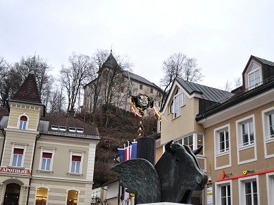
Monday
19.03.2018
A statue along the main street of the village. Bleuiburg / Pliberk is
very active from an artistic point of view, hosting several events and
being home to the museum dedicated to the Austrian painter Werner Berg
(1904-1981) who has dedicated his works to the landscape and the
inhabitants of Carinthia. Today his work represents a unique
documentation left as a legacy to this region on the Austrian-Slovenian
border. |
|
|
|
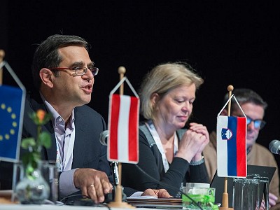
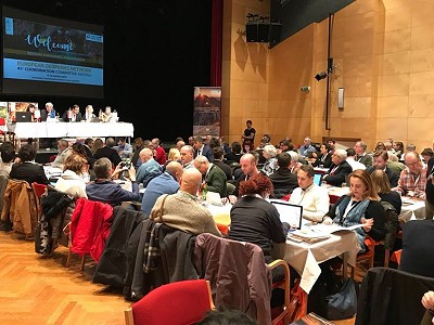
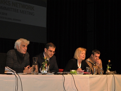
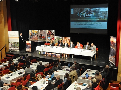
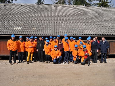
Wednesday 21.03.2018
The
41st Coordination Committee Meeting of the European Geoparks Network
starts. The Kulturni Dom main hall is crowded by the representatives of
the 71 European UNESCO Global Geoparks coming from 23 countries. At the
conference table (from right to left) the well-known Patrick McKeaver,
Kristin Rangnes, Nickolas Zouros, Guy Martini and Suzana Fajmut-Štrucl,
who welcomed the participants on behalf of the hosting geopark Karavanke/Karawanken
UNESCO Global Geopark.
|
|
|
|
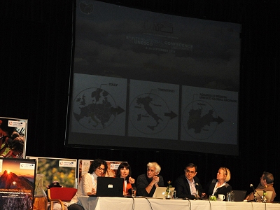
Wednesday 21.03.2018
In
the foreground table, part of the Italian delegation where you can
recognize two with the double “A” initials: Alessia Amorfini (Apuan
Alps) and Aniello Aloia (Cilento-Vallo di Diano) that, within the
network, are elected member of the Advisory Committee and coordinator of
the Italian Committee, respectively. |
|
|
|
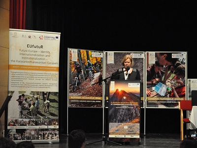
Wednesday 21.03.2018
Among the morning communications, an important moment, particularly for
Italy, is the one related to the next UNESCO Global Geoparks
International Conference that will take place in Italy, hosted by the
Adamello Brenta Geopark (Madonna di Campiglio, September 8 th -14 th,
2018) with the title "Geoparks and sustainable development". Violet Masè
illustrates the organization of the scientific sessions and side events
of the conference that will involve actively all the Italian geoparks.
|
|
|
|
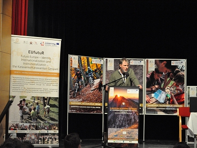
Wednesday 21.03.2018
Next, still a proposal by an Italian geopark. Tullio Bagnati submits the
application of the Sesia-Val Grande Geopark to host the 43rd meeting of
the European Geoparks Network in 2021. |
|
|
|
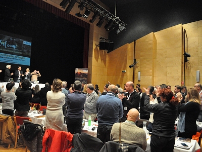
Wednesday 21.03.2018
The
meeting is going through a "historic" moment when the Committee tributes
to Nickolas Zouros, at the end of his mandate, a "standing ovation" for
the extraordinary work carried out for 18 years as coordinator of the
European Geoparks Network. |
|
|
|
Wednesday 21.03.2018
After the tribute to Nickolas Zouros, the procedure for the elections of
the new coordinator and vice-coordinator begins. The first candidate is
Kristin Ragnes from Gea Norvegica UNESCO Global Geopark, the currently
expiring vice-coordinator. |
|
|
|
Wednesday 21.03.2018
The
second and final application as the new coordinator is that of Chris
Woodley-Stewart from North Pennines UNESCO Global Geopark (England, UK)
who would like a change of strategy more directed towards the management
of the activities rather than the acquisition of new members of the
European Geoparks Network. |
|
|
|
Wednesday 21.03.2018
The
only candidate as vice-coordinator is Babbis Fassoulas from the
Psiloritis UNESCO Global Geopark (Crete, Greece). After a brief personal
presentation, Babbis illustrates the activities of the Geohazard Working
Group within the European Geoparks Network in which the Apuan Alps
Geopark participates actively. |
|
|
|
Wednesday 21.03.2018
The
voting results were as follows: valid votes 104, Kristin Ragnes 61
votes, Chris Woodley-Stewart 43 votes. Kristin Ragnes is then elected as
the new coordinator of the Coordination Committee of the European
Geoparks Network. In the photo Kristin in her first speech after the
proclamation.
|
|
|
|
Thursday
22.03.2018
The second day of
the 41st Coordination Committee Meeting of the European Geoparks Network
is dedicated to the open session on "Sustainable tourism and regional
identity in crossborder regions" which includes a pressconference and a
Geofair set up in the gym of the Bleiburg/Pliberk Kulturni Dom.
|
|
|
|
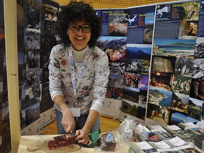
Thursday
22.03.2018
At the fair booth
reserved for the Italian geoparks a smiling Violet Masè is preparing a
delightful taste of speck from the Adamello Brenta Geopark. Behind her,
the banners of the Italian geoparks have made the Italian booth, as a
whole, one of the most attractive booths of the Bleiburg/Pliberk Geofair.
|
|
|
|
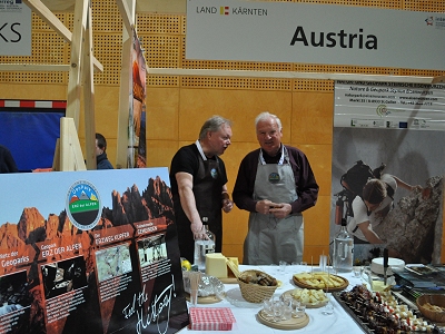
Thursday
22.03.2018
Helped by the
proximity to Bleiburg/Pliberk, the Austrian geoparks have set up a rich
food stand: cold meats, cheeses and schnapps! |
|
|
|
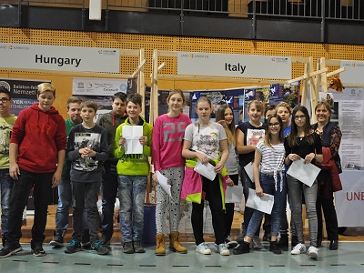
Thursday
22.03.2018
In front of the
Italian booth for a souvenir photo the students awarded as winners of
the competition held by the Karavanke/Karawanken UNESCO Global Geopark
on the values of cultural identity in crossborder territories. |
|
|
|
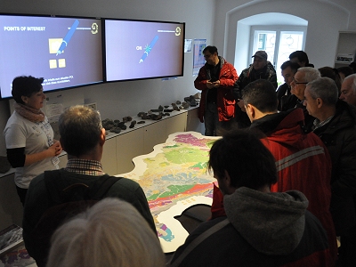
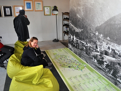
Friday
23.03.2018
Today is devoted to
the visit of the Karavanke/Karawanken Geopark. The first stop is at the
geopark information center called "World of Geology" in the Austrian
village of Bad Eisenkappel/Zelezca Kapla after a half-hour (about 25 km)
transfer from Bleuiburg/Pliberk. Antonia Weissenbacher illustrates the
contents of the information center addressed to the geology and tourist
offer of the geopark. She starts with the flagship of the "World of
Geology" center, the interactive Geopuls table that represents a
geological map of the Karavanke/Karawanken geopark area on which by a
pen camera it is possible to navigate through the characteristics of the
region, from the geological to the cultural and gastronomic ones with
different levels of in-depth analysis. |
|
|
|
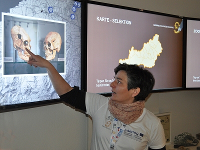
Friday
23.03.2018
Antonia shows some
topics of the Geopuls table. In this case they are the archaeological
ones concerning a symbolic place of the Karavanke/Karawanken Geopark,
the mountain of Hemmaberg/St. Hema, an important Christian pilgrimage
destination in Central Europe from 400 to 600 A.D.
|
|
|
|
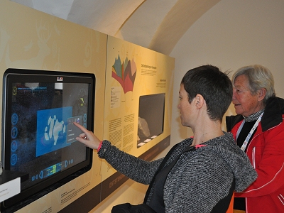
Friday
23.03.2018
In another room of
the information center "World of Geology", Sophie Justice from the
Chablais Geopark "plays" with an interactive panel where it is possible
to travel in the past (and in the future!) understanding the geological
process of plate tectonics.
|
|
|
|
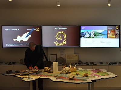
Friday
23.03.2018
The Geopuls table
is truly a must! ... Even after the end of the visit, Manfred Kupetz,
from the Muskauer Faltenbogen / Łuk Mużakowa Geopark, another
crossborder geopark between Germany and Poland, continues to take notes
on the operative principles of the interactive connections between
geological map and information. |
|
|
|
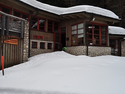
Friday
23.03.2018
The second stop of
the excursion is at the Obir Dripstone Caves. The tourist entrance,
about 1000 m a.s.l., is buried under the snow! The Karavanke /
Karawanken Geopark staff cleaned the 5 km of the access road to the
cave/mine for this extraordinary opening during the excursion of the
Coordination Committee Meeting of the European Geoparks Network. |
|
|
|
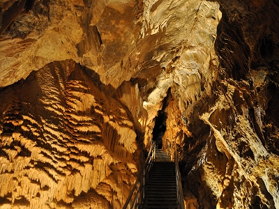
Friday
23.03.2018
The Obir Caves were
discovered in 1870 during the exploration of an active lead and zinc
mine and were used for tourism since 1991 after the cessation of mining
activity. The caves were formed inside the dolomitic limestone of the
Middle Triassic age. One of their characteristics is the very clear
interaction between calcareous concretions and the geological structures,
i.e. faults, along which the circulation of water is concentrated. In
the photo, a fault is visible above the steel staircase. |
|
|
|
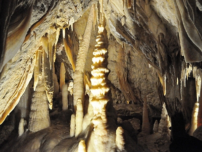
Friday
23.03.2018
The Obir Caves are
very rich in stalactites and stalagmites, often still living. In some
parts, as in the photo, there is a real overcrowding of calcareous
concretions! |
|
|
|
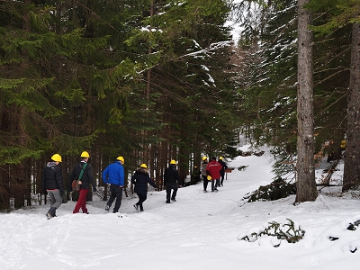
Friday
23.03.2018
The exit of the
caves is in the middle of a pine forest. The return to the road is along
a path in the snow. It has been an extraordinary and absolutely new
experience for the Coordination Committee of the European Geoparks
Network: it is the first time that the meeting excursion takes place in
the snow...the Karavanke / Karawanken Geopark will also be remembered
for this!
|
|
|
|
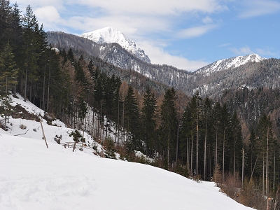
Friday
23.03.2018
The snow makes the
landscape even more impressive. In the background the highest peak of
the Karavanke / Karawanken Geopark, the Hochobir mountain (2139 m a.s.l.). |
|
|
|
Friday
23.03.2018
After a 45 minutes
long transfer and the crossing of the Slovenian border, we reach the
Mežica mine, the last stop of the excursion. In the Geopark information
centre, Alessia Amorfini is studying the geosites of the Karavanke /
Karawanken Geopark ... the most difficult test is to balance on a
"Fantozzi/Fracchia" type armchair! |
|
|
|
Friday
23.03.2018
After wearing
raincoats and helmets, ritual photos in front of the tiny wagons that
will bring the group inside the mine. The mine for the extraction of
zinc and lead was inaugurated in 1665 and was active until the 90s since
it was transformed into a tourism geosite. At the middle Suzana
Fajmut-Štrucl, geologist and director of the company that manages the
geosite. |
|
|
|
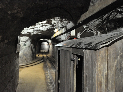
Friday
23.03.2018
The journey in the
small train, along the mining tunnels, completely in the dark and in a
deafening noise, is a unique and somewhat traumatizing experience. After
15 minutes to travel a distance of about 3 km we find ourselves in the
heart of the Veliki Vrh mountain formed by the dolomitic limestones of
the Middle and Upper Triassic at a depth of 600 m from the surface. |
|
|
|
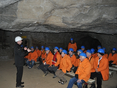
Friday
23.03.2018
In the large hall
of the mine once used as dining hall for the miners the guided tour
begins with the historical framework of mining already started in Roman
times and which has greatly influenced the economic and social
development of the populations of this region between Slovenia and
Austria. |
|
|
|
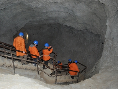
Friday
23.03.2018
The group descends
along the illuminated tourist route in different mine levels. In total
the levels are 20, the deepest ones currently completely below
groundwater level. |
|
|
|
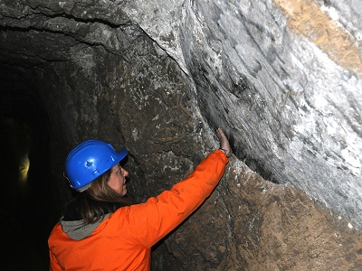
Friday
23.03.2018
Even in the Mežica
mine, rocks are frequently cut by fault structures. Alessia Amorfini
while "brushes" a fault surface where the relative sliding between two
rock blocks is visible. |
|
|
|
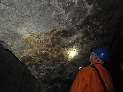
Friday
23.03.2018
In a darker section
of a mine tunnel, it is still Manfred Kupetz who lights up another fault
that cuts the dolomitic limestones; the fault surface is coated by iron
and manganese minerals. |
|
|
|
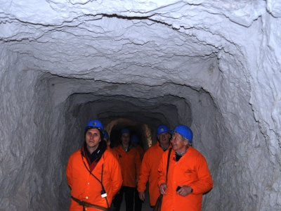
Friday
23.03.2018
The group continues
the visit along the tunnels of the Mežica mine. In the front row a
smiling Lorraine Chenot from the Monts d'Ardèche Geopark (France) and a
more worried Aniello Aloia from the Cilento-Vallo di Diano Geopark
(Italy). In the background we can recognize Tony Ramsay from the Fforest
Fawr Geopark (Wales) and Alessia Amorfini. |
|
|
|
Friday
23.03.2018
The 41st
Coordination Committee Meeting of the European Geoparks Network has
ended. A final image of the village of Bleiburg/Pliberk, dominated by
its own "lead castle", which has friendly greeted the representatives of
the European geoparks. |
|
|
 back to Conference page
 |
|
|
|
|
|
|
|