|
|||||||
|
|||||||
|
|
|
|
|
|
|
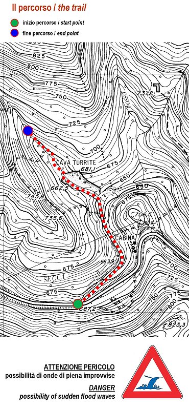
After you have parked the car at the edge of the provincial road n. 13
Valdarni (687 m above sea level), leading to Castelnuovo di Garfagnana,
you have to start walking along an old cart track, which goes on the
left and down towards the Turrite Secca river.
|
|
|
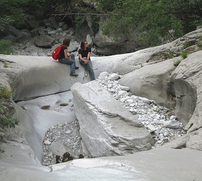
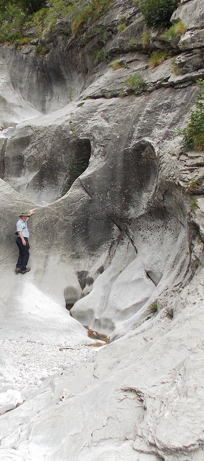
Before the
'70s, the last 300 m of the ditch descending from Mt.
Sumbra,
showed 13 large pot shaped cavities.
Their number was then reduced to the destruction produced years ago
from the abandoned quarries of the lower watercourse section.
The
survivor pot-holes, now protected by the Regional Park are easily observable continuing
the short route along the Anguillaja.
* * *
From
the main road
to
Val
d'Arni,
650
m
before
Anguillaja
stream, the
Fatonero
ditch
can be easily identified,
of which you can
view the latest 400-500 m stretch,
descended
from
Mt.
Fiocca.
The
pot-holes
are
numbered
in descending order
from the
upper part
of the
ditch;
they are
around
21 and
of similar size
to those
of the twin ditch.
|
|
|
|
|
|
|
|
||